 |
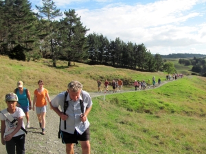
A group of 34 people took advantage of a rare opportunity to tramp across private farmland over a high
point in Wainui northwest of Silverdale. About eight more people came along, but pulled out soon after
the start when they realised they had commitments later in the day that they did not want to miss. Five
of us met at The Bracken at 1:30pm and met up with the others at Silverdale Hall at 2pm. From there we
travelled together via Upper Orewa Rd and the ruince to Lloyd Rd off Weranui Rd. Cars were taken around
to the finish point at the end of Bayer Road to ferry drivers back to the start point afterwards.
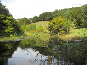
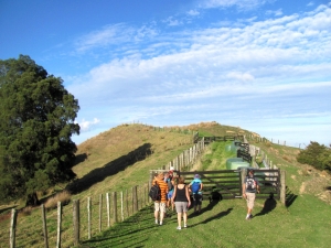
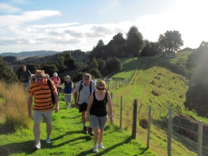
We set off at 3pm and went onto the Carodale farm, home of the Clay Bird shooting centre. The first part
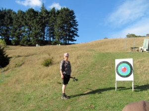
was a farm road passing a small lake and going up to the Clay Bird Cottage. Then there was a farm track
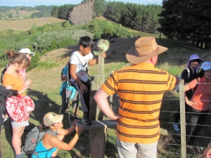
climbing up through the shooting range to come to a stand of pine trees. Crossing over into the neighbouring
property was a bit of a challenge with a stile with one of its supports broken away, and someone had
to hold it in place as we climbed over the stile.
|
|
|
|
|
|
|
|
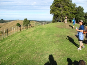
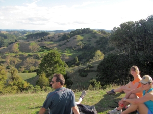
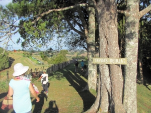
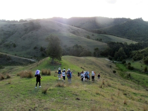
A walk along a farm track brought us to our final climb to the summit, known as Trevor�s Retreat
named after the farm�s owner Trevor Bayer. We arrived shortly before 4pm. There was a panoramic view
of the farm country all around, and we could see the urban area of Whangaparaoa Peninsula in the distance.
|
|
|
|
|
For our devotions John read the Easter story from the Kiwi Bible by Chris Crantham. Chris is working
on a project to present the Bible in NZ vernacular language, using such words as bloke, darn, suss out
and humungous. We all enjoyed this very entertaining and somewhat funny yet genuine rendition of how
Jesus Christ was tried, beaten, crucified, rose again on the third day, appeared to His disciples and
ascended into heaven. The command to the disciples to take the gospel message to all the ends of the
earth the risen Jesus gave before ascending has been perpetuated all the way through history, and this
is how we have come to know about salvation through and following Him today.
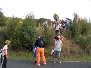
At 4:20pm we carried
on with our tramp, going through a holding pen before following a ridge down towards Bayer Road. There
was some confusion about the route, being on unmarked farm tracks, and this was where the ViewRanger
topo maps installed into a smartphone with GPS became very useful. We immediately realised we were on
the right track as we dropped down.
|
|
|
|
|
|
|
|
At the bottom some overgrown terrain and a barbed wire fence presented a bit of a challenge, but
we all got out safely at 5pm. The drivers were taken back to collect their cars, and the rest of us to
save time and keep occupied walked along the road for about half an hour till the cars arrived to take
us home. We all had a lovely time despite the challenges this unmarked route presented.
|
|
 |
COST: $10 travel from The Bracken
DISTANCE: 5.0km
MAXIMUM SPEED: 9.7km/h
AVERAGE SPEED:
4 km/h
|
|
|