 |
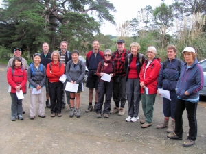
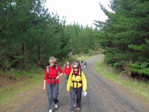
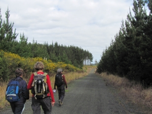
A cloudy windless winter day brought out 15 people to do a day walk through Riverhead Forest. 7 of us
left The Bracken at 8am and met up with the others at the Barlow Rd carpark on the western side of Riverhead
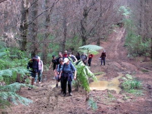
Forest. After the intros and karakia we set out at 9:15pm, carrying along Barlow Rd a short distance
before going onto a side track. The metalled road gave way to clay tracks that were muddy in places,
and we climbed up to rejoin Barlow Rd just below the trig about 10:30am.
|
|
|
|
|
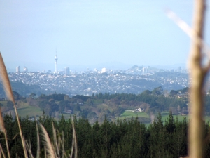
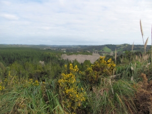
We had our morning tea break at the trig and lookout, where we could see out across the forest to
Auckland city in the distance with the prominent Sky Tower. A sign warned of a live firing range down
in the valley, and we could hear members of the local gun club practising their target shooting.
|
|
|
|
|
|
|
|
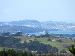
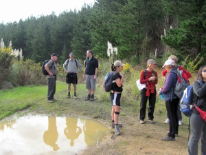
We carried on northwards along Blake Rd with the sound of the gunfire gradually fading away, before
going along Long Bush Rd. This was a gently undulating course along metalled roads through a mixture
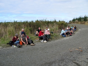
of mature and newly planted forest. Just after midday we arrived at the junction with Spinlay Rd and
had our lunch stop.
|
|
|
|
|
For devotions John read four passages from the Kiwi Bible, a project an Auckland comedian Chris
Grantham is working on to present the Bible in New Zealand vernacular language. Such a Bible will appeal
to people who would otherwise think of God’s Word as a boring old book, and these people would change
their attitude and embrace it and subsequently come to Christ. The text is in a funny and entertaining
manner - we enjoyed listening to the Creation story in Genesis 1, the Ten Commandments, the well-known
Psalm 23, and Psalm 139 about how God knows each detail of our lives, past present and future, and
really looks after us at each step in life’s journey. Kiwi slang words such as bloke, cark it and dunk
predominate in this version, which could be likened somewhat to the popular The Message version of
the Bible.
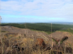
We left at 1pm and went down Spinlay Rd, a gradual descent, to come on to Campbell
Rd and later turn into Anzac Rd. This climbed up to a ridge where we could look down to the west side
of the forest and a brown patch of deciduous trees without their leaves.
|
|
|
|
|
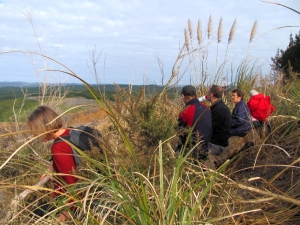
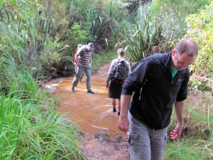
After a quick break on a side track we went into a stretch of cutty grass as we went down a trail
bike track and cross a stream before coming out once more to Barlow Rd. Ten minutes later we were back
at the carpark, finishing at 2:50pm.
|
|
|
|
|
We were grateful for the use of map GPS. Many of the tracks in the forest were not signposted, and
it would have been easy to take the wrong turning and get lost. On many past occasions the planned route
did not get followed due to the lack of a map GPS, as a map and compass were not totally inadequate.
In leading the way John was using his smartphone which had ViewRanger. This is an app that is available
for most smartphones, and the topo map for the whole of New Zealand can be installed at a low cost. The
GPS built into the smartphone gives the exact location on the map regardless of whether there is cellphone
reception. As a backup he also had a Garmin map GPS, and one of the others in the group was using his
map GPS. For all tramps in forest and other places with unmarked tracks a GPS with topo maps is essential,
be it a smartphone or a GPS unit, along with a hard copy of the map of the area and a compass. This would
apply for all tramps regardless of terrain or location.
John, Andrew, Glen and Hunter went to
Parakai for a swim in the hot pools while the others went straight back home, having enjoyed a nice easy
time in the forest.
COST: travel from The Bracken $8, or $10 including the hot pools
DISTANCE:
16km
MAXIMUM SPEED: 8km/h
AVERAGE SPEED: 4km/h
|
|
|