ROUTES taken:
OPTION A: SH32-Waihaha Hut : Waihaha – Bog Inn Hut: Bog Inn - over Mt Pureora to
Link Rd. (pack carrying over 2 nights)
OPTION B: SH32-Waihaha Hut : Waihaha- SH 32 & Centre of Nth
Is : Link Rd to Mt Pureora. (pack carrying over 1 night)
OPTION C: SH 32- Track – SH 32 & Rimu walk
: Waihora Lagoon & Centre of Nth Is: Link Rd to Mt Pureora (day walks)
Friday
A group
of 15 trampers set out on Friday night, travelling through Matamata for a meal stop, before diverting
off SH1 across to Mangakino at SH 32. Travelling off SH32 to the Kakaho Campground, then taking Link
Rd, next Swamp Rd, followed by Titiraupenga Rd, we hoped to make it to camp. We encountered a tree across
the road, delaying us, but fortunately our vehicles slipped under it. We eventually arrived at the YMCA
camp 11pm.
Saturday
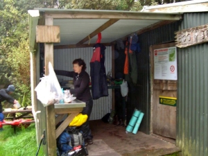
We rose to sunshine and discovered we could lighten up the camp
facilities by unscrewing the shutter-boards on the windows,(in place for security) and our gas supplies
were needed for the cookers. The petrol generator was needed for the lighting that night and the kindling
helped light the fire in the boiler to heat the showers.
We drove south on SH32 to the Waihaha
track parking area adjacent the main road. All three groups of Day walkers, one-night overnighters
(Option B) and two-night trampers (Option A) set off walking towards Waihaha Hut. Day walkers (3) took
a gentle pace and returned to the car park in their own time. They visited the Rimu Walk en-route back
to camp and reported some impressive Rimu Trees. The other groups of Options A and B (both of 6) proceeded
to a rocky outcrop and lookout, where Ali Norton led a reflective devotion sharing a prayer based on
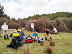
a topographical map of our soul. Further along an open grassy area provided a suitable space for a lunch
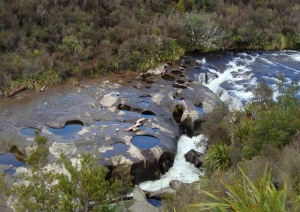
stop. As we tramped on we enjoyed the beauty of the bush, the towering rocky ridge across the gorge,
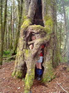
traversing a crater-like tea-tree expanse, and the river below with volcanic sink holes in the rocks.
Just 3 hours tramping brought us to the Waihaha Hut where 7 trampers set up their tents, one slept on
the verandah and four set up inside the hut. alongside the hunters already in residence. We enjoyed
a relaxed time in the sunshine before dinner. The calls of Kakas were heard and four flew overhead,
as well as the occasional Wood Pigeon. Ali shared an Enneagram Personality Profile and we were intrigued
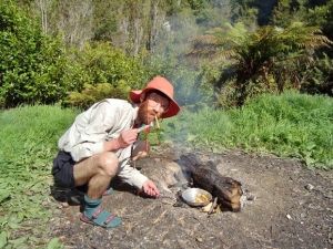
to identify our own personality type. Each group cooked their own dinners separately with stove lighting
practice for some.
Sunday and Monday - Option A
We set off at 8am to tramp north via
the Hauhungaroa Track, via Mt Weraroa to Bog Inn Hut. We left Waihaha Hut at 8am Sunday morning with
the sun shining. After an hours walking we started a steep descent to the Mangatu River. This was about
110 m. when we arrived at the river crossing we noticed a large dry tree log going completely across
the river. Some of the team were a little nervous about using the log and just wanted to wade across
the river which was only ankle deep in parts. Eventually we all crossed over the log and started the
very steep but short ascent. Thankfully, this didn't last for long and the rest of the climb got easier
as we went.
Around 11am it started to rain. This rain continued intermittently all day. By midday
we arrived at the junction of the Waihora Track, a climb of 325m from Mangatu River. We continued on
this track for about 30 minutes and passed the Waihora Lagoon. Another 15 mins further we stopped to
have lunch near a large camping area.
Straight after lunch we began to climb Mt Weraroa. Although
it was only a gradual climb of 300m, some of us were finding it tiresome. We arrived at the top around
2pm to wet, cold and windy weather. There was nothing to see so we moved on. The descent to Bog Inn was
very gradual and took us exactly 3 hours.
Being tired wet and cold we were hoping that we could
all stay in the hut, but a man with his two young boys were already there, so five of us tented and only
one stayed in the hut with a warm fire.
The next morning we were up early and away by 7:40am .
We had only been going for a few minutes when we came onto the Cycle Trail. Although we could see the
old track on the other side of the trail, it was no longer used or maintained so we kept to the trail,
which was very fast.
About half way up Mt Pureora, the cycle trail turned west towards Pureora
and we started back on the track to the summit.The sign said it was only 20 minutes to the summit but
we took 40 minutes. It was highly eroded and very difficult. When we arrived at the top, the weather
was cold, wet and windy. Although the mist would clear for a short while, we could not see very far. A
big disappointment.
As we were getting very cold, we decided not to wait for the other group,
so sent a message to them, and started our descent. This track was first class. Perhaps DoC are going
to do the same for the other track, which is why they say it is only 20 minutes. We had only been going
for 10 minutes when we met the other group coming up. Soon we were at the car park and thankful for another
amazing tramp with great company.
Sunday and Monday - Option B
On the Sunday we did the
return tramp back out to SH32. We appreciated the massively tall Totara and Rimu trees and the forest
beauty. With a few brief rests, we met the Day walkers group (Option C) on time at 12.30pm. Day walkers
had travelled from YMCA camp and explored the Waihora Lagoon track en-route. After a lunch stop, both
groups visited the Centre of the North Island before heading back to camp. The boiler fire had been
well stoked and the hot showers were most welcome! The gas barbecue was fired up that evening and a
delicious barbecue meal was served. Barbara shared a Devotion about Thanksgiving and we gave thanks
for the beauty we have enjoyed and our good health to be able to get out there and enjoy it.
Monday
morning Option B and C groups packed up and cleaned the camp. We travelled via Link Rd to the Mt Pureora
Track. After 50 min of climbing in a forest resembling ‘middle earth’ with the prolific lichen growth,
we met the Option A group already descending the mountain, on account of the uncomfortably cold conditions
at the top. Option B and C trampers continued to the top (another 10 min) but with no view and also
a squally shower, descended quickly. Lunch at a Mangakino cafe was most enjoyable before we headed north
to Auckland. David Titheridge shared his devotions in the van, based on a study of the compass points
in Scripture. Very fascinating hearing about the Biblical references to north, south, east and west and
their meanings! Our arrival at Bracken Ave was at 6.30pm.
|
|