| Auckland Baptist Tramping Club |

|
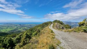
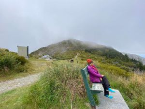
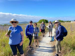
KAIKOURA DAY WALKS 1-3 Jan The Summer Tramps began with day walks in Kaikoura. The first of the day walks was a day walk up Mt Fyffe, on New Year’s Day. It was an incessant climb which was well worth it for the view, the experience and the opportunity to sit on the seat at the lookout. On the second day we did the Kaikoura Trail. This was a cycle trail that goes right around the back of Kaikoura and then comes out about 10 km up the northern beach and walks back down along the beach, so you can see the hills in the background. One group went to the minibus to the far end and halfway along the trail they met the group who were coming from Kaikoura swapped the keys. It was not quite as picturesque as we thought, but there were snippets of beach views and some interesting array of letterboxes and houses. The third day was the proper Kaikoura Peninsula walk with spectacular views down to the rocky coastline. What was impressive were the blues of the sea and the greens of the coastal vegetation. On the fourth day we went to Cheviot, about three quarters of an hour drive south and there was a again the same coastline and a very nice little walk. We saw spectacular landforms known as the Cathedral Cliffs, and walked the Hurunui Coastal Track at Manuka Bay with Barbara picking us up at the other end. |
| ||
|
|
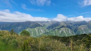
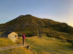
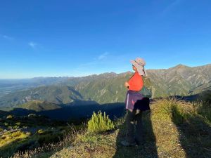
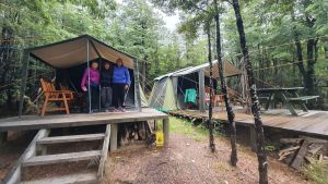
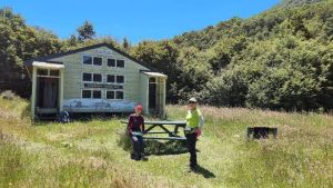
MT FYFFE OVERNIGHTER 1-2 Jan A group of 11 tackled the steady climb up to the Mt Fyffe Hut at 110m asl. We were fortunate to have the hut to ourselves, there were eight bunk beds, and some of us ended up sleeping on the floor. One could not book the hut in advance, it was first come first served. Next morning we were up as early as 5am to see the splendid sunrise on a clear day. We went on up to the summit of Mt Fyffe 1600m asl to enjoy spectacular views of the coast to the east and the mountains to the west. |
| ||
|
|
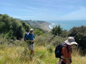
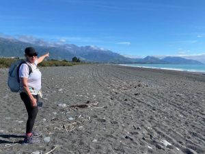
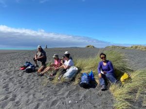
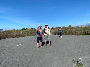
KAIKOURA COAST TRACK 4-5 Jan and 5-6 Jan There was such a response for this option that we had to have two groups do this walk, one group starting the day after the other group. Three farming families started the track on their farms in 1994 and have continued to diversify and work towards coastal protection and regeneration, winning awards for conservation. We began the trip at Beach House, arriving in time to cook dinner. As we sat outside in the sunshine we looked across to the Kaikoura Ranges. We set off the first morning, placing our food and luggage into a shelter to be taken to the next accommodation. So we just had to take day packs. As we walked the road access to the beach we faced a large group of Black Angus cows being herded down the road. The beach was quite black sand and shingles. It was a walk for two hours along the beach, past cliffs embedded with 8000 year old tree stumps and fossils. We could see seals playing in the surf. Our lunch stop was at the Circle Shelter amongst coastal bush. We spent some time enjoying ourselves there, before climbing up through open farmland with several streams to cross, to come to the Rest & Reflect on top of a hill on open pasture. It was blowing a gale up there so we didn't stay long. As we carried on we came to The Garden Cottage with a large bush of hydrangeas, and had another break at Heather’s Seat with views to the mountains. Passing Bruce’s Seat we came to a rocky knoll, and on through the conservation area of regenerating bush to the Medina homestead, our overnight stop. The second day sort of spread out a lot more but we stopped regularly to meet up and check everyone was going well. It began with an interesting van ride with Marlon as he told us stories of the area. We started our 13km walk by crossing forestry slopes to Buntings Bush stream and follow the bush-filled valley to the top of the Hawkswood Range. The beech forest was humming with wasps eating the honeydew. From the top we had immense views of the Seaward Kaikoura Mountains and the Pacific Ocean. After lunch in the shelter of Skull Peak day hut, it was down from the tussocks into bush and rolling farmland. We found ourselves back where you started at the Beach House at Ngaroma. The second group did exactly the same itinerary one day later. |
| ||
|
|
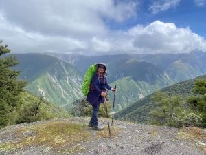
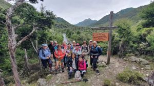
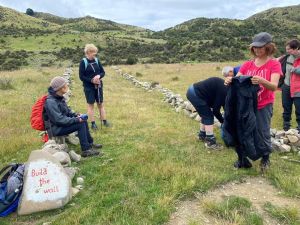
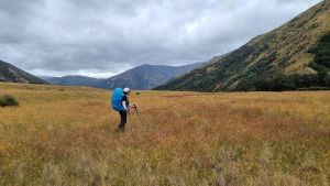
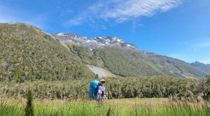
EAST WEST TRAVERSE 4-6 Jan This was a three day trek from Kahutara car park to Forbes Hut, Lake McRae Hut and through Molesworth Station. The first day was a 27km 9-10 hour hike to Forbes Hut. Phillip and Ali dropped us off at the Kahutara carpark. We went along a gravel vehicle track through grass flats and in to the mountains, climbing a zig zag route to a saddle where we had lovely views. Then it was downhill, and we had our lunch break. We went on up to Tent Poles Hut, a historic hut that had been used for mustering. Further on down, we came to Wardens Hut, having completed 2/3 of our day’s tramping with 9km to go. We saw a fellow from Aussie there. Then there was a river for us to wade across, and as we carried on along the vehicle track we saw layers of lava and blocks of chalk, a geologist’s dream. The Clarence River came into sight, and we arrived at Forbes Hut. Our second day’s tramp to Lake McRae Hut was a little shorter, 15.5km done in 7-8 hours. We had our second river wade-thru before leaving the Clarence River to crest another saddle, this time on a bush track instead of a gravel road. The track appeared to be overgrown, but we were able to find our way through what we called the valley of thorns, with some fallen trees and boot failure. We had our lunch stop at a bivvy. As we carried on up the valley the river appeared to shrink and we came to a field of purple lupins. We came to the shores of Lake McRae, and it was easy to sidle along the north shore of the lake. Then came our overnight stop, Lake McRae Hut at 790m asl, built in 1970. The water container appeared to be nearly empty, despite there having been no visitors to the hut for over one week. Day Three’s hike to Molesworth Cob Cottage was longer in distance, 22km, done in less time, 6-7 hours. Five minutes from the hut we were able to get our water for the day from a spring. There were more roses and thorns as we began our climb up Robinson Saddle. There was some sidling, the guy whose boot had failed was able to tackle the saddle easily in one boot and one shoe. We dropped down the other side of this open tussock and grass saddle, and we saw some goats. Eventually we came to a 4whd track, and we saw a herd of wild horses. We came to the Molesworth Cob Cottage, where we cooked our dinner and camped the night. The van came to take us to Hanmer Springs first thing next morning and settle into the Hanmer Springs Forest Camp. HANMER SPRINGS DAY WALKS 7-9 Jan The group was based at Hanmer Springs Forest Camp, a community-owned campground used for school camps. We were lucky to squeeze in to this already-full place, but with most of us off to Island Hills next day, there was plenty of room to stay, and we were well catered. It was great to sit down to a real coffee once more at a café. Everyone had at least one swim in the lovely thermal pools, quite therapeutic for those with legs sore from the tramping. The nearby Conical Hill was an easy one-hour return walk. Conical Hill was originally covered in tussock, and a zigzag track was cut to reach the 550-metre summit with its magnificent view. A variety of exotic trees replaced the tussock such as hemlock and cypress. At the summit a lookout offered a resting place and good shelter to view the Hanmer Basin. The Hanmer Forest Sculpture Walk also proved to be interesting, this display of wooden sculptures in the bush included a gorilla standing on one leg, a fantail, and some heads and hands clinging to trees. The next day some of us went for a walk up Mt Isobel. Beginning at Clarence Valley Road car park the track wandered through European and Japanese larches before entering subalpine scrub and open grassland. We got to the summit of Mt Isobel for panoramic views of Hanmer Basin and beyond. Some of went on down to the Waterfall Track, to meet others who had done this steep and challenging track from the bottom. ISLAND HILLS STATION 10-12 Jan Island Hills is a privately owned high country sheep station, and the hiking trails were developed in 2004, and opened under the name Hurunui High Country Track. In Jan 2008 the Club did this walk, a group of four joined by a surprise person who had booked independently and brought their own provisions. The following day another ABTC group of seven did the same walk. We drove from Hanmer Springs to The Cookhouse for the night. This had been built in 1914. The track operator met us next morning about 8:30am to welcome us to the property and conduct a safety briefing. They provided a 20 minute 4 wheel drive farm tour taking you to the entry point of the walking track, then they took our packs and supplies to our next accommodation. The van had two bench seats along either side, making us face one another as we travelled. Half of the sheep station is farmed with 1700 sheep and 170 beef cattle and the rest of it is regenerating forest. Wearing day packs only, our group of 13 set out on our first day’s walk of 11km, going past beehives used for making the Island Hills branded honey, and crossed homemade bridges over streams. There were grassy knolls surrounded by mountains. This felt like an oasis among the mountains as we took a break. Then it was a short hop up to Straggler Saddle for our lunch. It was downhill to Valley Camp Huts, where we had a welcome treat from “The Bush Janitor” including bottles of Lindauer wine and biscuits. Our second day was a 9km tramp to Bush Hut, following an old pack track. There was a snow fence built in the 1930s. We had our break in the bush and saw a concrete salt feeder for the sheep, and a quirky sign Not Nearly There, a taste of the Bush Janitor’s humour. A much better sign said 10 Min To Go. A walk along Bush Creek brought us to Bush Hut, which had been built in 1931 from native red beech logs. There were three glamping tents. The kitchen hut had 4 gas elements, a fridge, crockery and cutlery. We all enjoyed dinner on an outside table. Our final day’s walk to The Cookhouse was 9.5km. It was an easy and enjoyable walk over hill country farmland, through a field of clover, and along hillside tracks up to the top. Then down to the river. What must we do by the bridge? – pick up a stone and help build the wall. How may people have walked the track? – count the stones. There was one final grunt before we dropped down to The Cookhouse. A welcome back treat of cold lemon drink and chocolate brownie awaited us, plus a jar of Island Hills honey to take home. Murray drove the van while the rest of us walked over the “homemade bridge”. Distance 29.5km |
| ||
|
|
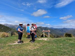
ST JAMES WALKWAY 9-13 Jan It was a one hour drive from Hanmer Springs to Lewis Pass, the starting point for the track. This was marked by a large prominent signpost on the roadside. Part of St James Walkway passes through the former St James Station. More than half of the track is part of Te Araroa, which joins between Christopher and Anne Huts at the Waiau River. We set out from the picnic area on the Tarn Nature Walk, walking across a natural open bog before entering the bush, descending in a steep zig-zag into Cannibal Gorge on the Maruia River. A swing bridge crosses Cannibal Gorge to the true right bank. From here it was a 6km walk to the Cannibal Gorge Hut. Past the hut the track followed an easy grade alongside the Maruia River, through beech forest and open alpine fields to Ada Pass Hut. The next day we followed the track through bush over Ada Pass into the Ada valley. The beech forest gradually gave way to open areas of tussock with tongues of mountain beech. We carried on through bush areas, following the true right bank of the Ada River. At the confluence of the Ada and Christopher rivers, the track passed the historic Christopher (Ada) Cullers Hut. About 15 minutes further on we came to the Christopher Hut, close to the edge of the bush, about 350 metres from the Ada River. On day three the weather was colder and more windy, but remained dry. We went down the valley along the true right bank of the Ada River to where the open flats converge with the river and toe of the hill, about 1.5 km above the Ada homestead. The track eventually joined a vehicle track for some distance to the Henry/Waiau valley confluence. From here it passed through matagouri thickets and some open rolling and swampy ground to rejoin the vehicle track. After crossing a suspension bridge over the Henry River the track followed close to the true right bank, rejoining the vehicle track through to the Anne Hut. As we tramped we met some trampers from England. Now that the COVID restrictions have been lifted worldwide, it is great to be able to chat with overseas tourists once more. The following day we crossed a footbridge over the Anne River to gain access to the true left, and 2 km upriver there was another footbridge back to the true right. The track continued up and over the Anne Saddle into the Boyle Valley. Orange pole markers indicated the route over the Boyle Flats, past the basic Rokeby Hut. The true left bank was followed to a suspension bridge over the Boyle River, 100 metres from the Boyle Flat Hut. We ended up camping out in tents that night. On our final day we we went on to the start of the track through the gorge. A suspension bridge crossed the Boyle River, then the track followed the true right bank to another suspension bridge. We came to a vehicle track and followed down the valley to the shelter and car park by the Boyle settlement, bringing to an end five interesting and scenic days of pack-carry tramping. |
| ||
|

|
|