|
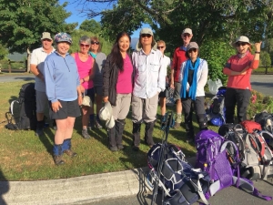
DAY 1 Control Gates to Luxmore Hut. (13.8 Km)
An 8.30am bus took us to the start. Brilliantly
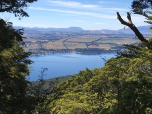
sunny weather and calm conditions provided stunning views! We enjoyed the level walk and lake views on
the way to Brod Bay, then a snack stop at this spot, along with numbers of other walkers. The climb
began gently through beautiful Beech Forest as the track turned away from the lakeside. Our group spread
out more as we continued the climb. After almost 2 hours ascending we reached the towering limestone
cliffs with structures and steps to guide us around them. We continued to climb a little more steeply
and took a group lunch stop in the shade of bush cover, before ascending to the open alpine terrain.
With the idyllic view of Lake Te Anau as a backdrop, Barbara began her reflection about native birds
by pointing out the Murchison mountains and noting the 1948 discovery of the Takahe, until then thought
to be extinct. An encouragement to think of those who have lost their faith and that it too can be rediscovered.
Reflecting on other native birds - like the Bellbird and Tui singing songs of praise from dawn till dusk,
let’s be those who have praising hearts. And like the thrill of the morning chorus, let’s together build
harmony and unity.
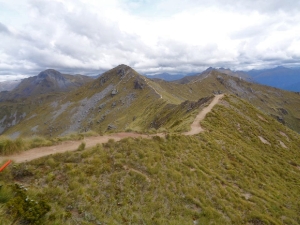
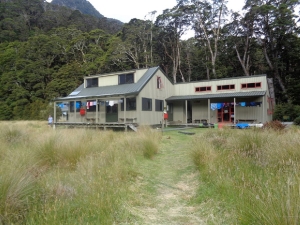
A short walk along the ridge completed our day’s tramp. Extensive and amazing
views seen out every Luxmore Hut window and cheeky keas on the roof kept us entertained.
During
the afternoon some walked up to Mt Luxmore to appreciate the 360 deg view, others visited the caves or
enjoyed the nature walk by Pat the Ranger, a very knowledgeable fellow!
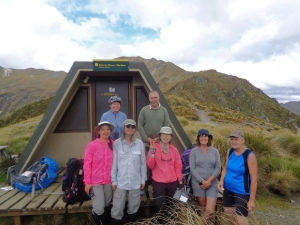
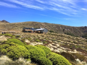
DAY 2 Luxmore to Iris
Burn. (14.6 Km)
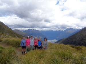
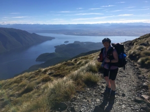
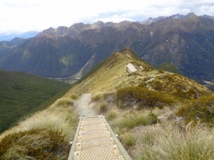
We set off in sunshine to climb toward Mt Luxmore. More of us took the side track
to the summit for the extensive 360° view. Bryan led the front group and Barbara trailed with the second
group of very keen photographers! The track traversed a good number of ridges overlooking the south arm
of Lake Te Anau. Calm shining waters and distant forested mountains were the subject of many more photos. A
snack stop at Forest Burn shelter, then more ridge walking to the Hanging Valley shelter for our lunch
break.
Now we also enjoyed views of Lake Manapouri, before descending many steep steps, into the
Iris Burn valley. A very steep zig-zag bush track took us many metres lower. With a ‘must be nearly
there’ feeling, met a sign stating ‘30 min to go’ to the hut.
Arrival and hot drinks were most
welcome! Some braved the sandflies to swim/be refreshed in the nearby river. Our ranger was very informative
regarding bird life. Jo and Bryan spotted four Whio (rare native Blue Duck)swimming past as they refreshed
in the river. Kiwis were heard and some woke to an amazing dawn chorus.
DAY 3 Iris Burn to Motorau
Hut. (16.2 km)
The sounds of the Kiwi had been heard overnight and the call of the long-tailed
cuckoo filled the morning air! As we left the hut a rising track soon levelled out, then we crossed a
saddle and enjoyed more gently meandering paths through lush moss and ferns and continuing Beech Forest.
We appreciated sounds of bird calls and the company of friendly South Island Robins on the track. Podocarp
forest then became more evident with Totara and Rimu trees.
After a lunch stop Bryan shared his
reflection on the history of the Kepler track named after Johannes Kepler who was a German astronomer/mathematician
in the early 1600’s. It is not well known that he was a committed Christian and protestant who suffered
persecution for his beliefs at the time. His motivation for his study of the celestial bodies was to
understand and bring glory to God. A quote from his book on planetary motion ends with "Crying out with
the royal psalmist: Great is our Lord and great His virtue and of His wisdom there is no number: Praise
Him Ye Heavens, Praise Ye sun and moon and planets…to Him be praise, honour and glory, world without
end"
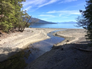
The waters of lake Manapouri came into view before a lakeside stop to test the water temp
at the warmest corner (so we had been told) and ‘yes’ it was almost tepid! The hut location, right on
the beach gave us ready access. Relaxing in the hot sun, swimming or wading and capturing the stunning
views were all part of our easy afternoon. The water was amazingly warm!
Our Ranger gave us a
comprehensive summary of the history of the lake relating to the Power Project development and the proposals
in 70s-80s to raise the level of the lake. His voice joined with many others finally halted the proposal
so we still have a beautiful lake with some islands with original forest.
DAY 4 Motorau to Control
Gates. (15.5 Km)
Departing at 8.20am, we enjoyed the level track, birdsong and beech forest.
Taking the Ranger’s advice, we paused to enjoy the calm waters of Shallow Bay, another opportunity for
scenic photos. Another side path took us on boardwalk to a unique and fragile wetland area where Bryan
pointed out a lilac coloured native orchid. Other species of fungus and small delicate plants gained
our attention along the track.
Onward along the moss lined path, we made good time until we reached
the Rainbow Reach pick-up area for a morning break.
Over lunch Tina led a short reflection
on Barnabas, the encourager, and encouraged us to be a positive and encouraging influence in others lives.
The path followed the wide Waiau River on our right for 9 more km until we reached the Control Gates,
completing the 60km Track at 1.30pm. Thankfully our Track Net driver was able to come early, taking
us back to the Te Anau Holiday Park.
|
|
|
|
|
|
|
|
|
|
|
|
|
|
|