|
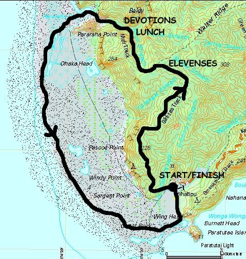
Base map: NZTopoOnline, extracted February 2005, Crown Copyright Reserved
|
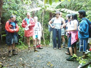
A drizzly wet morning did not stop 16 people from doing one of the Club’s perennial favourites, the round
trip from Whatipu carpark taking in the Gibbons Track, Muir Track, Pararaha Valley and the Whatipu coast.
The trip was to have been to the challenging Pararaha Gorge, but the leaders changed their minds to a
much easier tramp as it would be too risky to take less experienced people up a gorge with tough scrambling,
tummy-deep wading and almost-vertical climbing.
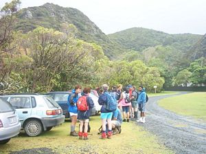
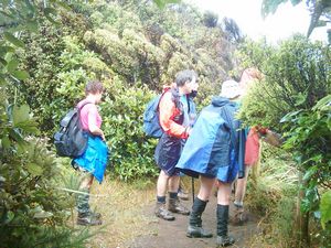
Leaving The Bracken soon after 8am we drove to
the end of Whatipu Rd to be greeted by a howling wind that was not experienced in central Auckland. We
set off about 9:30am to follow Gibbons Track, climbing up into the bush of the coastal Waitakere Ranges.
The raincoats we had donned to stave off the light rain soon came off as our bodies began to heat up
in the humid weather.
|
|
|
|
We soon came to a lookout point where we could see out to the coast and the Tasman Sea.
|
|
|
|
|
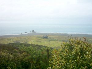
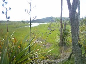
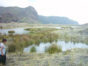
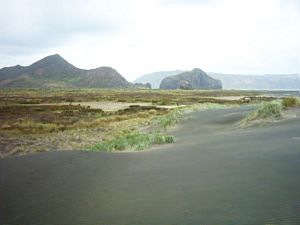
As the track levelled out to follow the clifftops we had a panoramic view of the broad sand-dune
and swamp flats bordering the coastline.
|
|
|
|
|
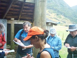
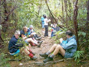
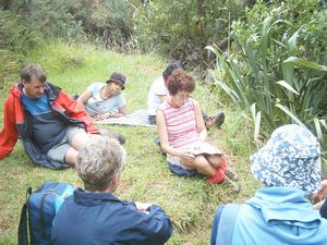
Later we decided to stop for elevenses. We asked a group of runners passing through in the opposite
direction how far the junction with Muir Track was, intending to have our stop there. They told us the
junction was half an hour away, so we made our stop on the track. Afterwards we got going - and found
the junction just half a minute away!
|
|
|
|
|
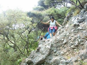
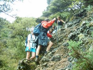
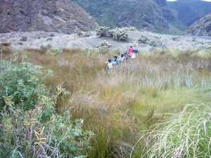
The descent of Muir Track was straightforward, except in one place where we had to take care negotiating
a rocky outcrop.
|
|
|
|
|
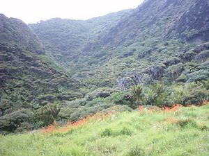
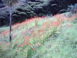
Red flowers blooming in the grass at the bottom of Pararaha Valley were evidence that there once
was a house and garden.
|
|
|
|
|
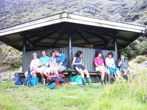
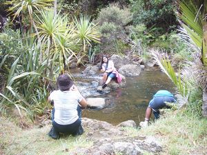
When we arrived at Les Ward Shelter we had a look at the crystal-clear Pararaha Stream before having
our lunch. Gill had brought her sacred silver lunchbox, and had also given John one of these lunch boxes
as a belated Christmas present.
|
|
Rosemary opened her Bible to Psalm 1, telling us that this passage of Scripture describes two types
of people. The righteous, who honour God and order their lives according to His will, and who do not
walk in the counsel of the wicked, are blessed, meaning most fortunate, and are watched over by Him.
They are like trees planted beside a river, which thrive as a result. The wicked are like chaff, here
today and gone tomorrow, and doomed to perish.
|
|
 |
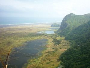
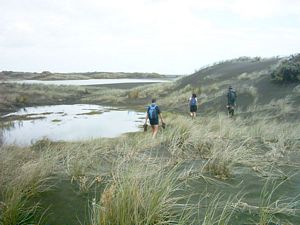
As we continued on into an open flat wetland, we could see a large sand dune ahead.
|
|
|
|
|
The summit of the dune afforded panoramic views all around.
|
|
|
|
|
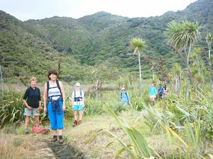
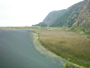
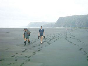
We carried on, crossing the wide coastal belt of sand and swamp to follow the coastline back towards
Whatipu. The grey-black colour of the sand testifies to its origin - Mt Taranaki when it was an active
volcano.
|
|
|
|
|
|
|
|
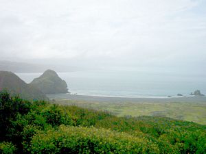
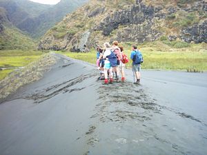
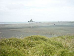
After about an hour of beach travel, we rounded the north Manukau head, passing Ninepin rock with
its lighthouse, and the prominent Paratutae Rock marking the start of the Manukau Harbour.
|
|
|
|
|
A ten minute walk from Paratutae brought us out of the blustery coastal winds to the Whatipu carpark,
where we rested at a picnic table, throwing a few scraps to some sparrows.
|
|
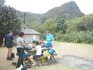 |
We were out by 3:30pm, and on the way home made our mandatory icecream stop at the Huia store to
complete an enjoyable and non-sweltering midsummer tramp.
COST: $7.
|
|
|