Twenty-one people have turned up for what has become one of the most popular tramps in the Waitakere
ranges - the walk along the beach to the Pararaha Valley and back over the hills along Muir and Gibbons
Tracks. The club last did this trip in February 2001, but this time as it was winter there was plenty
of mud and flooding.
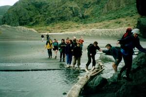
We left The Bracken soon after 8 am. and met up with more people at the road-end
at Whatipu. It was 9:30am by the time we set out on our tramp, heading out to the beach at Paratutai
Rock at the entrance to the Manukau Harbour.
|
|
|
|
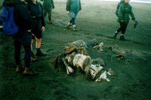
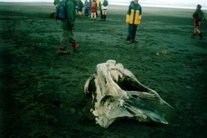
We continued along the beach past Ninepin Rock and right around to the Tasman Sea coast, stopping
at one or two mysterious objects on the way.
|
|
|
|
|
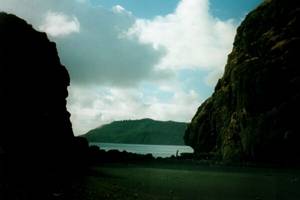
It was a pleasant walk along the broad sandy beach, with the roaring surf on our left and the rugged
hills of the Waitakere Ranges in the distance to our right.
|
|
 |
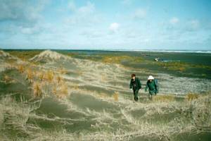
After about two hours we began to turn inland, crossing a broad belt of low sand dunes with scattered
ponds of water.
|
|
|
|
|
We came to the entrance of Pararaha Valley and on to the track to the Les Ward shelter.
|
|
 |
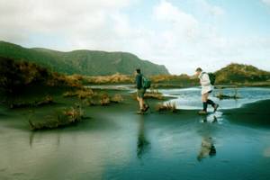
Because it was winter the track was flooded in places, meaning that we had to wade up to our knees.
|
|
 |
We arrived at the Les Ward shelter at midday, and stopped for lunch. This shelter had been built
in memory of Les Ward, an active member of the Auckland Catholic Tramping Club who did much in the early
days to encourage tramping in the Waitakere Ranges.
|
|
 |
Rosemary told us about how the sailing ship Orpheus ran aground on the Manukau Bar in 1863. The signalman
on the shore saw the boat when it was two miles out to sea, and gave the correct signal for the captain
of the ship to take the bar. The captain ignored the signal so the signalman once more gave the right
signal. The captain ignored the signal repeatedly this was because he was using an old map that was already
out of date, and the position of the sand bank had changed. The Orpheus eventually hit the bank, and
was wrecked with great loss of life. As Christians God is our signalman and our map is the Bible. There
are other maps such as New Age that are similarly incorrect, but the only real way is Jesus Christ. The
signalman gave the right signals, and so does God for the storms and difficulties in our lives. God is
on the mountain top, and He can see the storms that we have to go through. We need to keep on reading
and heeding His word.
It is not normal to have devotions on a Saturday day tramp, but it is
always nice to spend a few minutes thinking about God and Christ while out enjoying His creation.
|
|
 |
We then set off climbing Muir Track, a steady grunt coming out at the junction with Gibbons Track.
This was a good spot for a quick rest and to bring the group back together again.
|
|
 |
We carried on along Gibbons Track, which was very muddy because of the time of the year and all the
recent rain. The track followed the ridge and eventually came to a lookout where we could see out to
the coast where we had walked that morning.
|
|
 |
The track then descended to Whatipu. It was so slippery that several of us fell over. We arrived
back at the car park about 3:30pm having enjoyed a lovely beach stroll, a talk about our heavenly Dad
over lunch, and some slushy muddy tramping.
We finished with our customary ice cream stop at
Huia. The weather was so cold that many of us opted for a coffee instead.
COST: $5
|
|