This year, our February summer weekend trip was to the Waitangi area, to include the Kerikeri-Waitangi
Te Araroa Foot Trail, and the Waitangi National Trust Mangrove Walk - two easy walks in the Bay of Islands
area. Overcast weather most of the time made for pleasant tramping for ten people, instead of the discomfort
that would be experienced on a hot sunny day.
Friday
We left The Bracken soon after
6:15pm in Max’s van and Gary’s car. Our munchie stop was at Wellsford, then we continued on to the Twin
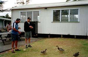
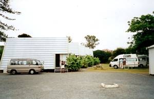
Pines holiday park at Haruru, just west of Paihia. We had the use of three chalet cabins at a special
price, and as soon as we arrived, after 10pm, we were so tired we did not bother about supper and crashed
for the night
|
|
 |
|
|
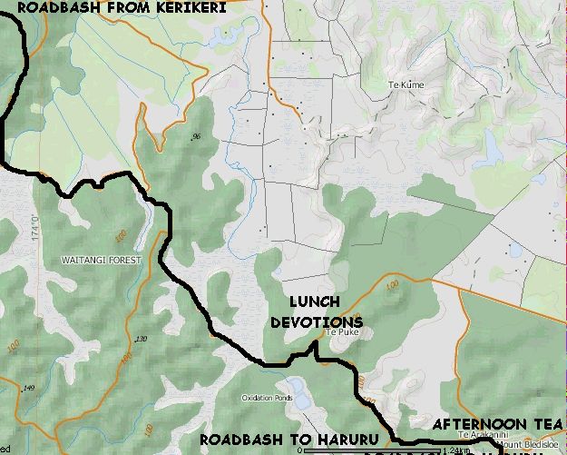 |
Base map for both map illustrations on this page: NZTopoOnline, extracted April 2003, Crown
Copyright Reserved
|
|
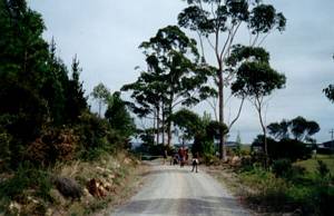
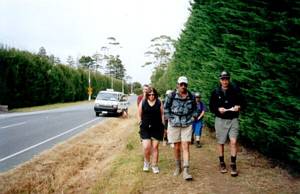
We went to the start of the Te Araroa Kerikeri-Waitangi foot trail by taxi van, as we all wanted
to do the walk and the fare shared amongst ten people would be only $3-50 each.
Our taxi could
not arrive before 9:45am as it had another job to do, and our driver took us to the Kerikeri Inlet Rd,
where we began our walk.
We had a few km roadbashing to do before we entered the forest, just
over the Okura River.
|
|
 |
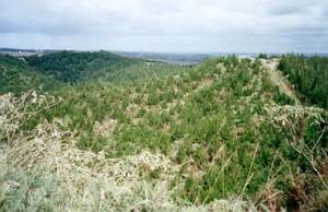
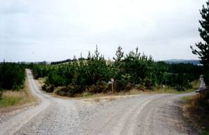
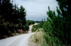
The Te Araroa foot trail follows roads through the Rayonier Waitangi Forest, and is the first part
of the proposed Cape Reinga-Bluff Te Araroa walking trail to be established, having been opened by keen
tramper and former prime minister Jim Bolger in 1995.
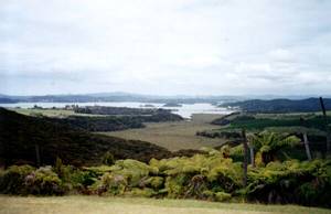
We set out along Te Wairoa Road, climbing
gradually for the first 1.5km to the junction with Bedford Rd., a viewpoint where we could look out to
the Kerikeri Inlet and westwards towards Kerikeri and the surrounding countryside.
|
|
|
|
 |
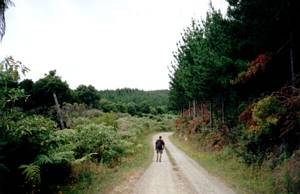
The road followed an undulating course along a ridge to the turnoff with Bluegum Rd, where we had
a quick morning tea stop.
|
|
 |
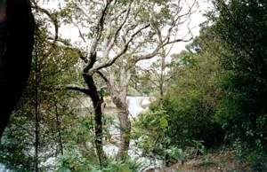
We then dropped down to cross an area of swamp and follow the contour between pine-clad hills and
a broad flat area of native bush.
|
|
|
|
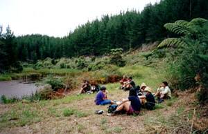
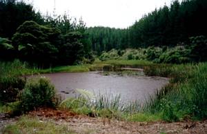
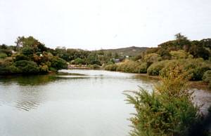
Our lunch stop was beside a pond near the junction with Furness Rd. Judy shared some thoughts about
Jesus as our shepherd. In New Testament days a shepherd is a bit different from today’s sheep farmers
- a shepherd would look after each sheep, taking loving care of each one in his charge. He would carry
a bag of food to feed the sheep, use a sling for a weapon against wolves and thieves, and carry a staff
to keep the sheep from wandering, and use it as a rod under which he would get the sheep to pass under
while inspecting them for marks, sores, etc. Jesus laid down His life for us just as the shepherd would
lay down his life for his sheep. He would lead the sheep into new pastures (Psalm 23), and goes ahead
of His sheep, always there to comfort and sustain us. The shepherd would stay and sleep at the gate of
his pasture - Jesus is our gate into the kingdom of God. John 10:11 I am the Good Shepherd. The Good
Shepherd lays down his life for the sheep sums it all up. (John 10:1-16 is worth reading on the theme
of Christ as our shepherd)
|
|
|
|
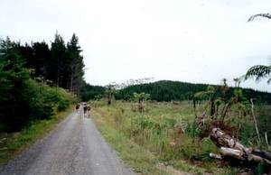
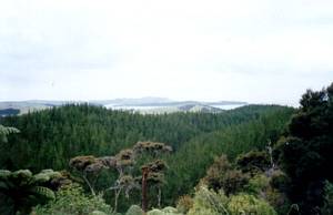
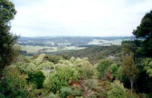
We had a short grunt to the next junction, with Diesel Rd, then more level travel along
wetland and cuddling the edge of hills before another uphill to the junction with Te Puke Rd. The Te
Araroa trail went on to Te Puke Rd, climbing up to a ridge with views out to the northern Bay of Islands.
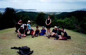
A short walk along the ridge brought us to public road and the five minute sealed path to the summit
of Mt Bledisloe. The mown grass clearing was an excellent place for a rest stop, and we had panoramic
views over the whole Bay of Islands, and south to Haruru.
|
|
|
|
|
|
We had decided, because of transport difficulties, to start the tramp with the taxi van to
Kerikeri, and finish by leaving the trail at this point and walking the 2km downhill roadbash to Haruru
Falls and Puketona Rd, with the Twin Pines camp just 200m further on.
|
|
 |
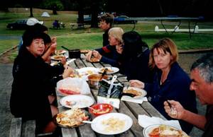
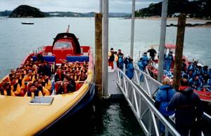
Our afternoon tea was back at the camp, on the picnic table, then we piled into the vehicles
to spend the rest of the afternoon at Paihia. We arrived at the wharf about 4pm in time to see the Mac
Attack and Excitor full of excited tourists dressed in uniform buoyancy suits about to leave for a
one-and-a-half hour high-speed cruise to Cape Brett, which each one would have paid $65 for.
|
|
 |
What was the Paihia aquarium a few years ago was now a cafe with an aquarium of large fish in the
middle, free to view! After some icecreamerology, we returned to the Twin Pines holiday park, and had
our dinner at the picnic table.
|
|
|
|
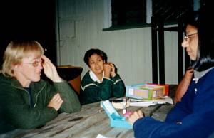
Later on Judy brought out a game of Taboo, a word-guessing game that kept our brains on the ball!
|
|
 |
|
|
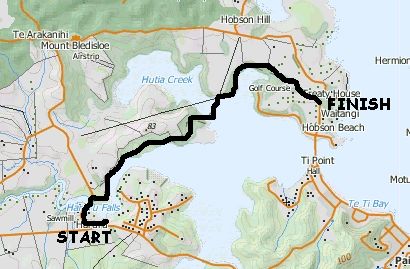 |
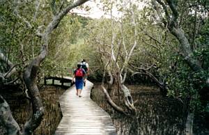
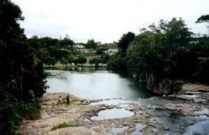
After breakfast and packing up, we walked the Waitangi National Trust Mangrove Walk, a 2.5 hour track
starting at Haruru Falls and finishing at the Waitangi Treaty House grounds. It began as a bush track
following the northern bank of the Waitangi River. In one place we saw two shags’ nests perched high
in a tree.
|
|
|
|
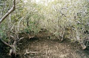
About two-thirds of the way along the track we came on to a 300 metre boardwalk going through real
mangrove forest. Mangrove trees in Northland estuaries grow very high, 5-6 metres or more, effectively
forming areas or strips of forest whose floor is covered by water at high tide. When the tide is low,
the floor is dotted with pneumatophores, small growths that look like shoots of new trees but are in
fact the breathing organs of the adult trees’ roots.
|
|
|
|
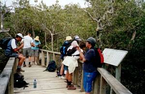 |
At the end of the boardwalk we crossed a bridge and gradually climbed away from the water’s edge
through bush towards Waitangi. Near the top there was a lookout where we could look back down to the
mangrove forest and the bridge we had crossed.
|
|
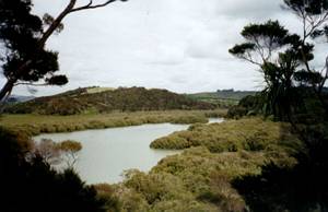 |
The track came out to a grassy carpark across the road from the Treaty House grounds - we were out
of the track just before midday. To ensure no dogs or pushbikes are brought onto the Waitangi National
Trust Mangrove Walk, which is within a kiwi conservation zone, there are specially built turnstiles at
both ends of the track, at Waitangi and at Haruru Falls.
|
|
 |
We had thought of the Treaty Grounds as our lunch spot, but decided to save ourselves the $10 entry
fee and eat our lunch on the foreshore at the north end of Paihia. It was pleasant and a little breezy,
not awfully hot to make anyone go on for a swim.
After the mandatory ice cream stop in Paihia,
we travelled home with a quick stop on the Whangarei bypass road for the two vehicles to have their lunch
courtesy of Gull. We arrived at The Bracken about 5pm, finishing a pleasant relaxing weekend of exercise
and fellowship.
COST: $82-50.
|
|
|
|
|
|
|
|
|