|
 |
This trip focussed on an area new to the Club - the western end of the Tongariro Forest, near Owhango
in the King Country between Taumarunui and National Park. In July 2000 the Club had explored the other
end of the forest, at Mangatepopo. Apart from the 42 Traverse, and local walks near Mangatepopo and Ongarue,
the tracks within the forest are not marked, and it is essential that a map and compass be carried, and
a GPS if available would also be useful to confirm altitude and grid readings.
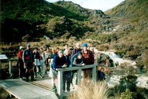
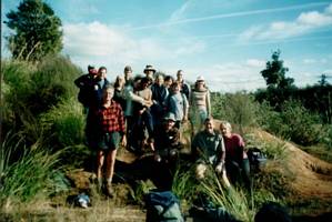
Eighteen people
came on this adventure into a wilderness that has been left untouched since the logging gangs moved out
of the forest a number of decades ago.
Friday
We left The Bracken soon after 6:15pm
and after the customary munchie stop at Ngaruawahia we headed southwards bypassing Hamilton and travelling
through Te Kuiti and Taumarunui to arrive at Owhango shortly before 11pm.
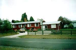
Our accommodation was
at the Forest Lodge in the township of Owhango. This is a small lodge and motel unit sleeping 20 people
in all. Bedding was provided in the bunkrooms, so we did not need to bring our sleeping bags. There was
a kitchen and lounge/dining room with colour TV.
|
|
 |
Saturday
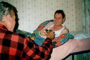
The day dawned clear, crisp and cold. Tummies were warmed by the Vice-Presidential
Cups of Tea in Bed Service by our honorary Cupsofteaserologist in his distinctive red bush shirt.
We left the lodge at about 9am and drove into the Tongariro Forest along the start of the 42 Traverse
(Dominion Rd). Our intention was to drive up the Water Supply Rd to The Skids, but we found that road
could only be tackled by Gary’s 4x4 vehicle (4x4 vehicles are only allowed on the public access roads
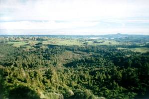
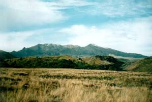
in the forest; they are forbidden from going along any of the tracks). The rest of us set out walking
up the road, and soon we came to a viewpoint where we could see across the Taumarunui valley to the hills
in the distance including the conspicuous flat-topped Hikurangi.
|
|
 |
Gary came back in his 4x4 to ferry the rest of us up to The Skids. While we were waiting for the
last ones to arrive, we could see out southwestwards to Mt Egmont in the distance.
|
|

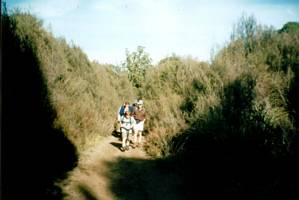
Once everyone had arrived we set out along a track heading southwestwards through the cutover bush.
It was a wide track that was originally one of numerous logging tracks and tramlines in the area, and
kept open by trail and quad-biking enthusiasts.
|
|
 |
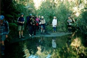
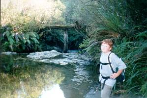
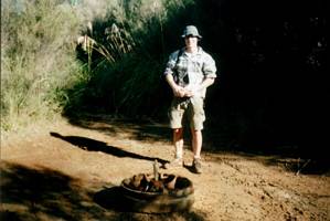
Eventually we came to Falls Creek, where the track forded the stream - the remains of an old bridge
was nearby but we could not tell whether it was a road/foot bridge or a tramline bridge.
|
|
|
|
We saw on our map a dam nearby, and found a track leading off to our left that could possibly lead
to it. So we followed it, but it went on and on and on, and there was no dam to be seen - just plenty
of scratches on our legs (for those without long trousers) from the cutty grass. The general straightness
of the track and it several cuttings made it quite obvious that it was once part of a bush railway.
From there we went back across the stream and followed Climo’s Track, which was also probably a tramline,
that climbed very gradually northeastwards. In one place a frog was seen to leap ahead of the frontperson
and dive into a puddle.
We eventually came to a junction marked by a wheel from one of the trains
that had taken felled logs out of the forest on their way to the mill.
|
|
 |
It was 11:40am when we arrived at the junction, and we had a vote on whether or not we should go
on to the Ten Bunk Hut, another 45min along a downhill track and having to return the same way. Consensus
decided we flag this and have our lunch at the junction instead.
|
|
 |
The smoothness of the track at the junction was no indication of the conditions we would be facing.
Just around the corner either way - the track to the Ten bunk hut, and more of Climo’s track (which we
would be following) became very muddy with two deep ruts formed by generations of quad-bikes etc.
|
|
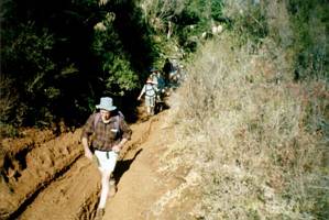 |
A little further along Climo’s Track we turned into Mud Track, that certainly lived up to its name!
After about an hour of sloshing and edging our way around deep muddy puddles we could once more see Mt
Egmont in the distance, a sign that we were just about back at The Skids.
|
|
|
 |
We were out by about 2pm and had a bit of a rest before heading back down Water Supply Rd to our
cars.
Gary took as many as he could in his 4x4, including three hangers-on, while the rest of
us enjoyed a lovely mud-free downhill walk.
Our original intention was to walk the Ohinetaonga
Track on Sunday morning, but as we were out much earlier than anticipated we had time to explore this
for the rest of the afternoon, as this was on our way back to Owhango.
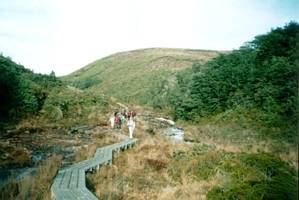
The Ohinetaonga Track was
one of the well-signposted local walks in the forest, and was a welcome contrast from the mud we had
to put up with. The track was a well-formed bush track that soon passed a swimming hole in the Whakapapa
River and crossed a road before climbing up to a large tree, possibly a totara or rimu, that had a viewing
platform built at its base.
|
|
 |
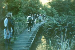
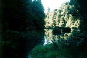
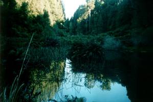
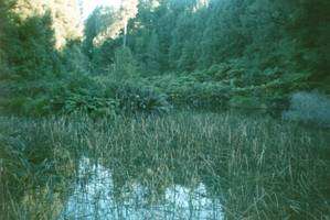
We then carried on, climbing over a ridge to drop down and cross the lovely Ohinetonga Lagoon, very
reminiscent of ponds in city parks. The lagoon would be very colourful in the middle of a sunny day,
but there was something special about the lake even on a late autumn afternoon.
|
|
|
|
|
|
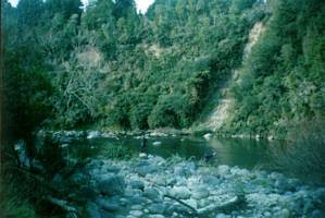
Afterwards we carried on to cross the 42 Traverse road and climb steadily up through the bush. Later
we began to drop down, and could see the Whakapapa River below us.
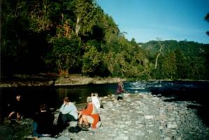
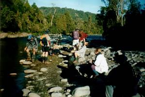
The Boat Hole on the Whakapapa
River was a lovely place to have a rest stop. Fantail birds were dancing back and forth over the river.
|
|
|
|
A short walk brought us back to the car park, and we headed back to the lodge. We were treated to
a lovely dinner of chicken and vegies, followed by apple shortcake and cream. Although primary-school-age
David baked the shortcake, he decided not to eat any of his delicious work himself!
Afterwards
Gary, whose family was brought up in the area, told us a little about the history of the area. The Tongariro
Forest was extensively logged for native timber from the beginning of the 20th century, both on the plateau
and from the bottom upwards. Before the timber could be logged, tramlines and tracks had to be built,
a process that would take several months, and in some cases up to a year. All cuttings had to be done
manually by pick and shovel. Mills were also set up to cut up the logs - there were three mills at Ketetahi
alone. Life in a logging camp was tough - all gear had to be brought in on a long trek into the campsite,
and there were many financial troubles. A worker would typically spend six weeks in a camp before taking
a ten-day break.
He told us that our day’s tramp into the forest was mostly on old tramlines
and logging tracks. The junction we had our lunch at was a major junction with a staging post and possibly
a workers’ camp.
During the weekend we were able to browse in the lounge not only Readers Digests
and old womans weeklies, but also a large book on bush tramways in New Zealand and a small book on the
history of Kakahi, a tiny settlement not far from Owhango - these two books belonged to Gary, and he
had brought them along especially to share with us.
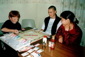
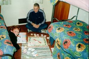
Most of us went to the local hotel to watch
the Crusaders beat the Highlanders, a very important rugby match that was being broadcast on Sky TV from
Christchurch. John, David and Yeppe preferred to stay back and trade hotels, houses and land over the
monopoly board.
|
|
 |
Sunday
The morning started with a red sunrise and, once again, the red bush-shirt Vice-Presidential
Cups of Tea in Bed Service
|
|
 |
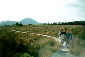
We set out at 8:30am headed for the slopes of Mt Ruapehu and the two-hour Silica Rapids walk. As
we headed out of Owhango towards Raurimu and National Park we could see the mountain looming up ahead
of us; we could also see Ngauruhoe and Tongariro. We carried on to Whakapapa Village (The Chateau) where
we left one of the cars, then drove on to the start of our walk 2km further along the Bruce Road.
The track set out crossing a lava flow covered in subalpine tussock and scrub. To our left we could see
Ruapehu; to our right we could look down to the southern King Country; behind us were Ngauruhoe and Tongariro.
|
|
 |
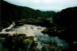
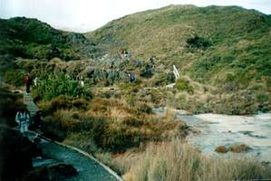
We eventually dropped down to the Silica Rapids themselves. The stream comes out from beneath lava
cliffs at the head of the valley; after about 50 metres the stream becomes aerated and the aluminosilicate
material that had dissolved in the water while underground now precipitates on the stream forming the
creamy white deposits on the river bed.
|
|
|
|
 |
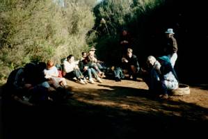
As we took a break to admire the fascinating rapids, Alasdair told us that coming into an outdoor
environment brings people into a different aspect of God’s creation from that in the workplace or city
living. When King Solomon was writing the Book of Proverbs in the Bible, he must have sat down and
observed what ants do (Proverbs 6:6-8) - they have no leader or boss, they all know their places and
work together, very orderly and tidily. An ant has been seen to carry a whole leaf alone; for a man to
carry such a proportionate load it would be impossible to build a crane strong enough for the weight!
God has given an enormous strength to the ant to be able to do this. There is so much we can learn from
nature; we need to acknowledge God in nature. We finished our devotion with a time of prayer, remembering
some people who were prevented from coming through sickness, and singing God is so Good.
The
track carried on following the stream downwards entering the bush. We eventually turned sharp right and
crossed some areas of open tussock, with Ngauruhoe in the distance ahead, to finish just above the Chateau.
|
|
|
|
There was time to visit the DOC visitor centre and have a coffee in the nearby cafe before we headed
back to our lodge at Owhango for lunch and final clean-up. Most of us had our lunch in the lounge and
dining room, but David and Jeppe were content to have it around the monopoly board on the floor of their
dorm.
|
|
 |
We were away soon after 1pm for the four-hour journey home to Auckland. Another happy enjoyable weekend
away just finished.
COST: $86 (travel $42; accommodation $35; food $9)
|
|
|
|