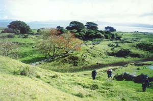
Twenty-seven people took the opportunity to have a look at one of Auckland’s newest reserves, the Otuataua
Stonefields in Mangere. This area between Puketutu Island and the airport had only been open six months
(10 February) and is steeped in history, both human and geological. These stonefields stand on lava flows
from two volcanic cones, and were extensively gardened by the Maoris and farmed by European pioneers
with the stones used for garden plots, houses, farm fences, etc.
At the start, shortly after 2pm
when we were introducing ourselves and committing the tramp to God as we usually do, we sang Happy Birthday
to John, the leader, as it happened to be his birthday, and Lin handed him a card signed by several Club
members at a pot-luck dinner the night before to farewell another member on an overseas trip.
From
the park’s main entrance at the end of Ihumatao Quarry Road we walked up to the top of the Otuataua Cone,
the larger of the two cones and which was quarried for its scoria. The quarry was now covered in mature
grass, and one could hardly believe it was just bare scoria just six months before. From the top, on
the edge of the former quarry, we had good views out over the reserve and out to Manukau Heads and towards
the airport.
|
|
|
|
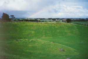
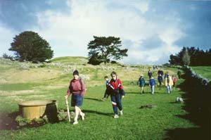
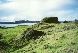
We then returned to the road end and followed the trail of blue-painted stones (which mark a geological
walk) to the base of Puketaapapa cone. This is the smallest of the 60-odd extinct volcanic cones of the
Auckland area, being less than 10 metres above its lava base and having a saucer-shaped crater only 12
metres wide. Unfortunately we were not allowed to go to the top of this cone as it was sacred to the
Maoris.
|
|
|
|
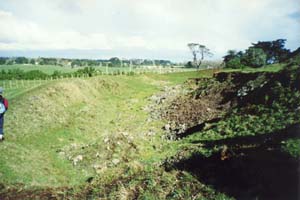
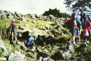
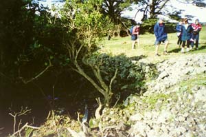
Our next point of interest were two lava caves to the northeast of Puketaapapa. The first of these,
Lino Cave, was a hole in the hillside dropping steeply away, and was blocked by a grille to prevent children
falling in. This cave takes its name from speleologists taking a sheet of linoleum into the cave to facilitate
travel through the jagged and narrow 90-metre interior.
|
|
|
|
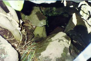
Rubbish Pit Cave was easily identified by a depression in the ground that had rubbish and bones in
it, hidden under a tree. We could not see any hole in the ground in the pit - this would have been formed
by the roof of the cave falling in. However we saw a small mound with a tiny opening nearby, which would
be part of the same 50metre-long cave.
|
|
 |
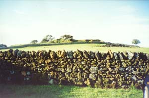
We then walked across the paddocks, divided by stone fences and containing some old very low stone
fences that the Maoris would have made to fence off their garden plots as a way of establishing “microclimates”
within each plot to enable their crops to grow bigger and faster, to come to the Manukau Harbour edge.
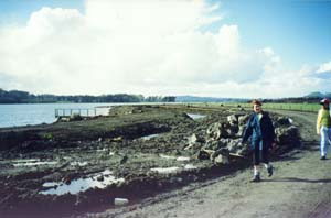
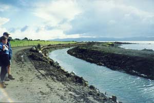
The two oxidation ponds to the south of Puketutu Island had been dismantled just a few months before,
and the area is now part of the tidal waters of the harbour. There is a five-year construction project
under way to restore the coastline to its original state, with the eventual dismantling of the two remaining
ponds and restoring safe bathing to the inner beaches of the Manukau Harbour such as Waikowhai and Hillsborough
Bay. We came onto the road that skirted the edge of those ponds, and followed it to its western end,
where the ponds had finished; the point being marked by the edge of the mangrove area beyond being a
straight line.
|
|
|
|
 |
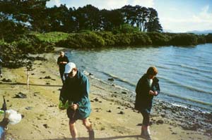
From there we went across more pasture to come to a delightful little beach facing the Manukau Heads,
and our afternoon tea stop. The tide was right in, and we could imagine this as an idyllic beach in the
summer with people swimming up to their heads just a few metres away, and boats out on the harbour -
whereas in fact the beach was very shallow and at low water dries out to extensive sand and mud flats
going many kilometres away from the shore. The shallow nature of most of Manukau Harbour and the swift
tidal currents make the harbour not at all popular for boating. But it was a lovely spot with a stand
of macrocarpa pines beyond, and a good outlook down the harbour.
|
|
 |
By now it was 4:30pm, so we made our way back to Ihumatao Quarry Road directly across the paddocks,
following a long stone fenceline, and were back at our cars by 5pm, having had a very interesting and
informative afternoon.
|
|
 |
|
|
|
|
|