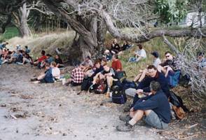
A balmy autumn day brought out the largest crowd seen for some time on a Saturday trip - 46 people -
to explore Mahurangi East, the portion of Mahurangi Regional Park that is situated at the north head
of Mahurangi Harbour. This reserve is only publicly accessible by boat, or by a long walk along the coastal
foreshore from Martins Bay at low tide. We were fortunate to get special permission to cross the private
farmland between Martins Bay and the reserve, but on one condition - the farmers will not give permission
to any individuals wanting to repeat this trip with friends, or to anyone wanting to do the tramp individually
as a result of reading this report on the internet.
We left The Bracken soon after 8am to rendezvous
with people from the North Shore and Rodney District at the foreshore carpark in Martins Bay at 9:30am.
Leader John gave a general briefing, and co-leader Geoff organised the entry and parking of our cars
onto the farmland.
Geoff led the convoy of cars on the farm as far as the first woolshed, and
because of limited parking space at the second woolshed we had to ferry the group in just six of the
dozen or so cars.
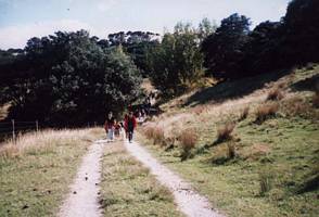
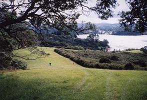
The tramp to the start of the regional park took about one hour. We followed
the farm road as it dropped steeply then climbed over another little hill.
|
|
 |
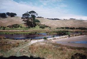
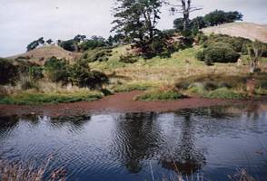
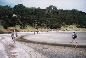
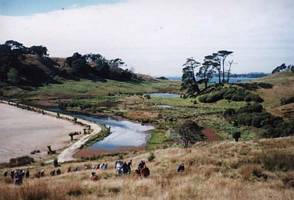
Because the people at the second farm house valued their privacy, we had to leave the main track
and go across a causeway separating a lovely little wetland from the tidal inland beach.
|
|
|
|
From here we cut through pasture to a ridge and followed it to get back on to the main track just
before the boundary gate to the park.
|
|
 |
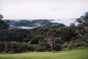
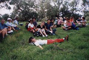
From the gate there was a climb up to a lookout, being the highest point in the park, where we had
our morning tea stop under a large pohutukawa tree out of the hot sun.
|
|
 |
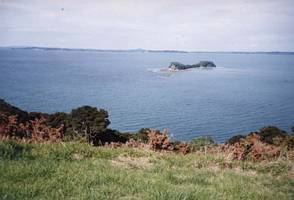
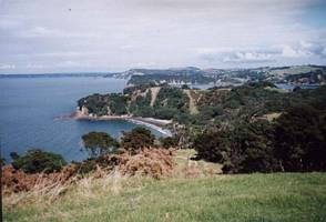
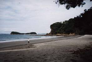
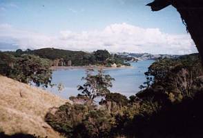
There was a view point where we could look out over Big Bay with the south Mahurangi coastline and
Whangaparaoa Peninsula in the distance, and Saddle Island offshore. Behind Whangaparaoa Peninsula we
could see the top of Rangitoto Island and some of the extinct volcanoes of Auckland (Mt Eden etc) as
well as the Sky Tower.
|
|
|
|
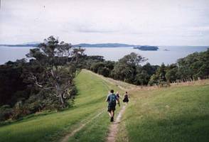
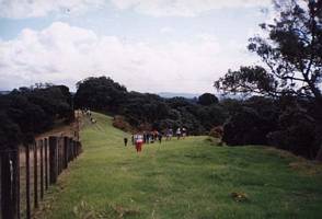
We carried on along the track to its end, following a sharp ridge between Big Bay and Lagoon Bay.
Because the land right on the northern headland of Mahurangi harbour was private farm land, we were not
allowed to proceed any further.
|
|
 |
From there we dropped down a very steep grass track to Big Bay, where we had lunch on the foreshore
in front of a small private bach.
|
|
|
|
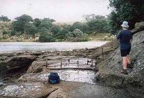
John, Paul, Barbara, Dorothy and Heather did a quick walk around the rocks at the south end of Big
Bay to have a quick look at Dairy Bay, where Barbara�s grandma was born. As we were running short of
time, we did not actually go to the beach itself, just stopping for photos at the fence across the rocks
to keep stock on the private land behind the bay from escaping into the regional park.
|
|
|
|
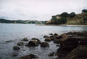
Afterwards, we climbed up the main access track to Big Bay, steep but not as steep as the way we
came down, to come back on to the main track. From there we went down into Lagoon bay, a lovely little
bay facing across to Scott Point and Casnell Island, and containing a lagoon at high tide.
|
|
|
|
We climbed up from there and crossed over to Poplar bay before beginning the long grunt up to rejoin
the main track at the puriri tree where we had our morning tea stop. This was to be our afternoon tea
stop before we returned to our cars the way we came.
|
|
 |
It was 3pm when we finished our tramp. The drive along the farm was a lovely trip, much of which
was along the clifftops overlooking the eastern coast between Martins Bay and the regional park. The
two carloads who were to go to Waiwera hot pools afterwards changed their minds and joined some of the
others for our customary ice cream stop in Warkworth before heading back to Auckland.
|
|
|
|
|
|
|
|
|
|
|