|
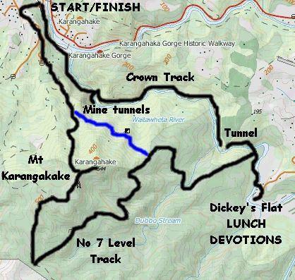
Base map: NZTopoOnline, extracted July 2003, Crown Copyright Reserved
|
40 people showed up for a perennial Club favourite - the Karangahake area near Paeroa. This time we would
be walking the fairly new Crown Track to Dickey’s Flat, and after lunch we would have the choice of returning
the same way, climbing the Dubbo 96 Track to sidle around Mt Karangahake back to the start, and climbing
the Dubbo 96 Track and on up to the summit of Mt Karangahake.
We left The Bracken about 8:15am,
and arrived at the carpark beside the Karangahake Hall. The hall itself was open - it had changed very
little, inside and out, since one of the members of our group stayed overnight in it on a Christian bike
tour for high school students back in May 1964. He recalled being constantly woken up all night by all
the trains that roared past - now the railway line has gone, and the rail route enjoys the relative silence
of strollers and trampers.
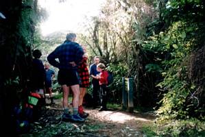
Meeting time for everyone, including some from Waihi and Tauranga,
at Karangahake Hall was 10am. After a briefing, introductions and customary prayer, we headed along the
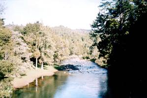
Karangahake Walkway as far as the Waitawheta River.
|
|
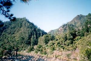 |
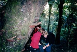
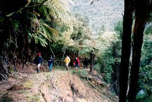
The Crown Track, just over a year old, followed the Waitawheta River into the spectacular Waitawheta
Gorge, following the route of an old pipeline.
|
|
 |
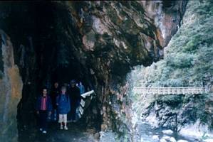
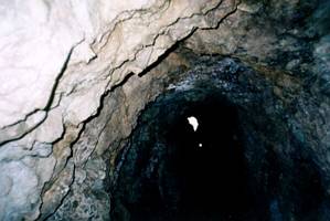
We explored a side track that went through a tunnel to some of the old Crown Stope workings. These
included a couple of old mine tunnels, one of which had the remains of an old tramline. At one stage
we could hear the whistle of a steam train?
|
|
|
|
|
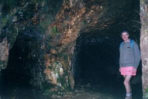
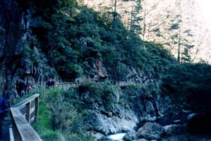
We returned to the main Crown Track and crossed a bridge across the gorge before continuing up the
gorge alongside the river, passing a few more old mine tunnels.
|
|
 |
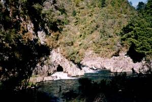
Later, we came to a spectacular view of the river cascading partly over a small waterfall and partly
through a tunnel. This was immediately before the track went through an old mining tunnel 180m long.
|
|
|
|
|
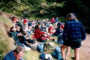
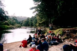
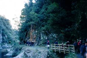
We crossed a swing bridge to the junction with the Dubbo 96 Track, and after a further ten minutes
we crossed another swing bridge to arrive at Dickey’s Flat, our lunch stop, about 12 midday. It was nice
having our lunch beside the river - that was until a passing shower arrived and we took to the nearby
trees for shelter.
|
|
 |
|
|
|
Katrina shared a story about a man who was told by God to PUSH his hardest at a large stone until
it moved. This man kept doing this, day in and day out, and yet the stone would not move. The devil told
the man not to push so hard but the man kept on going. The moral of the story is that when we hear from
God we should not use our intellect to make our decision but to step out in faith, ie. Pray Until Something
Happens. Katrina read two Bible verses to support this - Colossians 3:23-24 Work hard and cheerfully
at all you do, just as though you were working for the Lord and not merely for your masters, remembering
that it is the Lord Jesus Christ who is going to pay you, and 1 Corinthians 15:58 Be strong and steady,
always abounding in the Lord’s work, for you know that nothing you do for the Lord is ever wasted.
At about 1pm we left to return to the Dubbo 96 Track junction. None of us wanted to do the easiest
option, returning to Karangahake the way we came; all of us went on to Dubbo 96 Track which was a one
hour climb through bush, steep in places, to come out on the No 7 Level Track.
|
|
|
|
|
The group split up into two - Ruth took those who wanted the shorter walk and some cafeterology at
the Talisman back in the Karangahake township along the more direct route back to the start, around the
side of Mt Karangahake. Katrina took the others up to the Karangahake summit via the No 7 Level Track
and Mangakino Pack Track.
No 7 Level Track was a wide track, obviously an old road that served
the upper levels of the Karangahake gold mines. In a couple of places, where the track crossed a slip,
we were able to look out towards Waihi and the eastern Bay of Plenty.
|
|
|
|
|
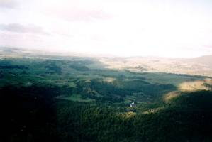
After an hour we arrived at the junction with the Mangakino Pack Track, at about 3pm. The formation
of No 7 Level Track carried on, but was not part of any track and would finish at the boundary of the
Kaimai Mamaku Forest Park. The track to our right climbed up to join the Karangahake Mountain Track,
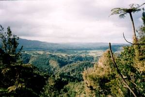
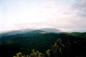
and we reached to summit of Mt Karangahake about 4pm. There was a view almost all around - below us to
the east was Dickey’s Flat where we had come from; beyond was Waihi and the Eastern Bay of Plenty with
the faint outline of Mayor Island on the horizon; to the north we could see the Karangahake Gorge and
township, and the Firth of Thames beyond; to the west we could see a shower passing over the Hauraki
plains; and southwards the summit of Mt Te Aroha, the highest point in the Kaimai Ranges, was covered
in cloud.
|
|
|
|
|
 |
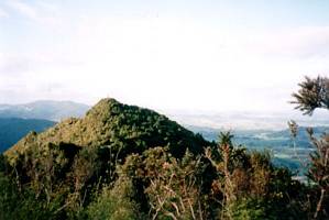
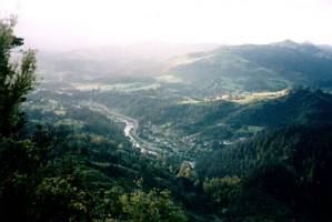
We descended Mt Karangahake the more direct way - a steep track through bush then scrub down
the northern slopes of the mountain to join up with the Karangahake Mountain Track near the bottom. We
had good views of the Karangahake area on the way down.
|
|
 |
It was 5pm when we arrived at the Karangahake Hall carpark complete with tired legs from a big
but enjoyable day’s tramping. At least one person was well and truly in bed back at home with her head
on the wentilillo sound asleep by 8:30pm!
COST: $15
|
|
|