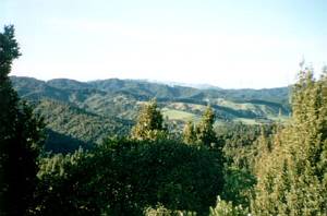
This tramp in the Wairoa Dam area of the Hunua Ranges was to have been done as the Club’s end-of-year
tramp last year, but persistent rain put a stop to that. This time the weather was a bit kinder, and
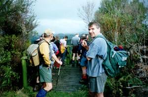
seventeen people showed up for the tramp. Two car loads left The Bracken soon after 8am, and the others
had met at Clevedon at 8:30am.
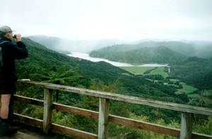
We started from the carpark at the start of the Wairoa Dam road
off Moumoukai Rd and climbed the Suspension Bridge Track as far as the lookout tower just before the
junction with the Wairoa Cosseys Track.
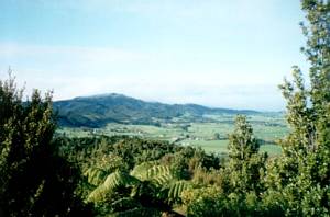
From the lookout tower we could look out to the farmland
of the Hunua valley and beyond, as well as further into the Hunua Ranges.
|
|
|
|
|
|
|
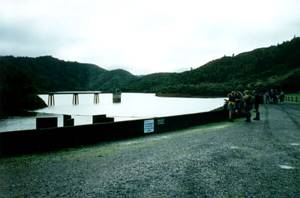
It was a quick drop down the Wairoa-Cossey Track to come out at the Wairoa Dam, our morning tea
stop.
|
|
 |
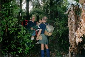
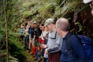
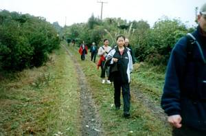
We then went down the Wairoa Dam access road to the start of the Wairoa Loop Track. This was a steady
grunt up to the Repeater Ridge. There were a couple of less-used side tracks to our left - although our
track was obvious Peter, the leader at the front, called a stop at each one to ensure the whole group
kept together. There were several fallen trees across the track that were not there when the four leaders
reccied the tramp two weeks before; since then there had been a severe storm that caused extensive flooding
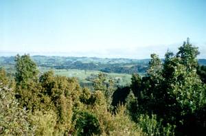
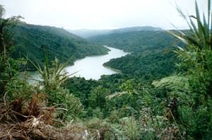
and damage in Northland and Coromandel. Near the top, we took a short side track leading to a lookout
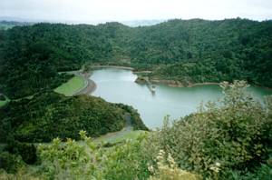
where we could see westwards to the Wairoa Dam and reservoir, with the farmed Hunua valley in the distance.
|
|
|
|
|
 |
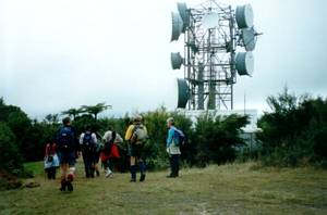
Once on the main track again, we soon came to the radio repeater station at the end of the Repeater
Road vehicle track.
|
|
 |
As we continued along the vehicle track, light drizzly rain began to set in.
|
|
 |
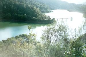
We arrived at out lunch stop, the Mangatawhiri lookout just off the Repeater Road track, about 11:45am.
Once the rain eased off, we could look down to Mangatawhiri Dam and Reservoir.
|
|
 |
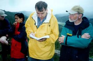
Geoff mentioned that there are very few references in the Bible to hilarity, the title given to this
tramp, but there are numerous references to joy and confidence. Reading from Psalm 27, he said that
there is confidence and joy in the midst of hard times. God deliberately brings troubles and hard times
into our lives to try and steer us towards a more personal relationship with Him, and to learn more about
Himself. Geoff recalled having to spend a whole year in a mental hospital 25 years ago, and how he began
to learn of God in this environment of great hardship and suffering.
|
|
 |
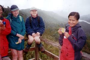
One lady handed around a box of chocolates. On each wrapper there were some facts about different
famous people, made good reading while eating the chocolates!
|
|
 |
Back on our feet again, we continued on a little way, then turned into the Wairoa Valley Track,
dropping downhill quickly. The track was generally well formed, but muddy and a little rough in places,
and we crossed the stream several times (over bridges) in the hour we were on the track.
|
|
|
|
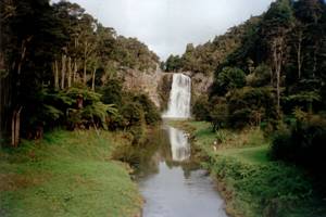
We were out back at the car park about 1:30pm. On our way back to Auckland we stopped to have
a look at the Hunua Falls, a raging cascade after all the recent rains!
|
|
 |
We were back at The Bracken as early as 3:30pm, just as showers were setting in for the rest
of the day.
It is interesting to note that when the leaders reccied the tramp two weeks before,
one of them brought a GPS with him, and entered a series of waypoints at various points on the tramp
such as junctions, lookouts, etc. from readings taken at these places. When the same GPS machine was
taken on the tramp itself, each waypoint was checked for accuracy, and most of them were found to be
out of place by varying degrees up to about 200m! It was also noted that waypoints set manually from
maps or by software from compatible CD-ROM topo maps may not show completely accurately either.
COST:
$7
|
|
|