|
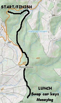
Base map: NZTopoOnline, extracted May 2003, Crown Copyright Reserved
|
Sixteen people took the opportunity to explore the southern section of the Hapuakohe walkway in the north
Waikato. We spilt up into 2 groups, with one group starting at either end of the track, and swapping
car keys when crossing one another at our lunch stop.
The first group, led by David and Marian,
started on the Ohinewai Rd, accessible from State Highway 27, and set out about 9:50am. The second group
went in from the Mangapiko Valley roadend.
From Ohinewai Rd, the track entered bush for a 15 minute
drop to cross a stream and begin a long grunt up to Maungakawa trig.
|
|
 |
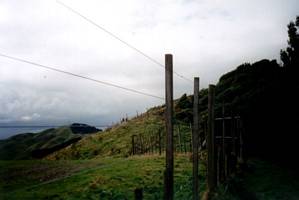
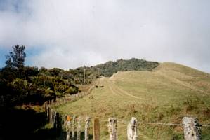
The track eventually reached a fenceline, and we could see the Maungakawa summit ahead of us. It
looked like an easy stretch from this point, but in fact the track went back into the bush to drop down
a little before further grunting.
|
|
 |
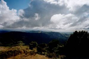
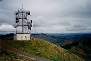
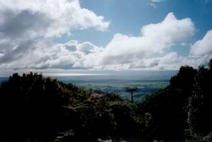
The first group arrived at Maungakawa trig about 11:30am. There was a microwave station (not for
cooking meals but for relaying telephone calls), and a panoramic view over the Firth of Thames, Miranda
coast, the farm country of the north Waikato, Lake Waikare in the distance, and approaching showers.
|
|
|
|
|
 |
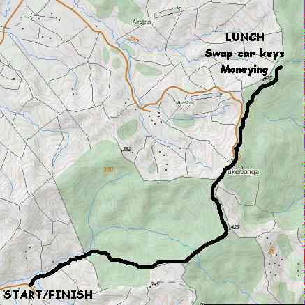
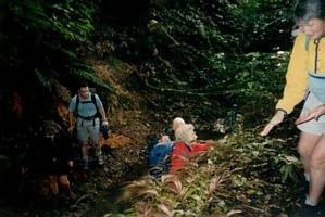
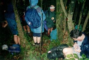
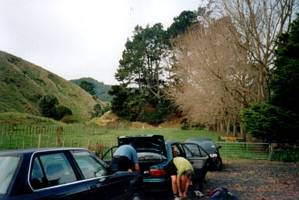
From Maungakawa the track dropped down following a fenceline for half a kilometre before entering
the bush. Both groups met up about ten minutes into the bush, and we had our lunch, just as the showercloud
we saw from the trig arrived to do its work. Huddled under our raincoats, we swapped car keys and did
our moneying - each person had to pay $6 to the owners of each of the two cars they would travel in.
We could hear in the distance, despite the pitter-patter of the rain, the sounds of steam trains and
mouth organists!
|
|
 |
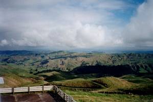
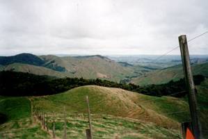
The rain eased off as we carried on our way. The track continued through bush on an undulating course,
coming out to another fenceline, which we followed up to our second summit, Pukeitionga, arriving soon
after 2pm. The transmitter station here was not used for cooking dinner or phone calls, but for making
sure everyone in the north Waikato would be able to watch Coronation Street and Days of our Lives.
|
|
|
|
|
 |
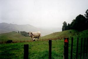
We now had a steady downhill for over an hour to the end. First of all it was through farm paddocks,
following a fenceline, before entering the Mangapiko Valley Scenic Reserve. There was a more level stretch
before the descent resumed. Later the track followed a fenceline for a short distance, where we could
look down into the misty Mangapiko Valley.
|
|
 |
The track went into bush again, dropping down steadily to come out to open bracken scrub - perhaps
looking much different from The Bracken. At the bottom of the valley, we came out into farm land to follow
the Mangapiko Stream. The first group came out at 3:30pm.
|
|
 |
The second group did all this in reverse, starting with the long grunt to Pukeitionga, then
on to Mungakawa, with a big downhill and a little grunt to finish off, coming out about the same time.
COST: $12 ($6 each paid to owners of cars travelled in)
|
|
|