
Fourteen trampers braved blustery winds to climb two of Auckland’s “mountains” - the non-volcanic Hamlins
Hill, one of Auckland’s Regional Parks, and the extinct volcanic cone of Mt Richmond, an Auckland City
reserve.
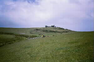
Starting at the park entrance in Great South Rd, Southdown, we followed a vehicle track
climbing into the rolling pastures of Hamlins Hill. These pastures, with the reservoirs on top, have
been for over four decades a familiar sight to motorists travelling the Southern Motorway but only in
the last five or so years has it been a regional park. They were originally holding paddocks, or “death
row”, for sheep and cattle awaiting the Southdown and Westfield freezing works.
|
|
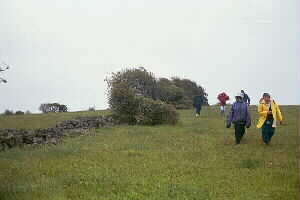
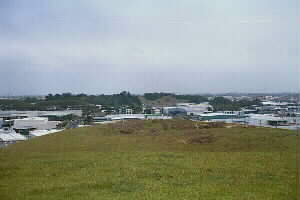
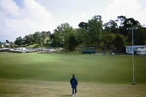
We walked across the paddocks, now leased for grazing cattle, to the northern edge of the park to
get a view of the Southern Motorway and the relatively new eastern expressway that links Southdown with
Pakuranga. Then we went into a broad gully and followed a mown track through an area of grass that had
not been “mown” by grazing. Further up the gully we took a track through an area that was being regenerated
into bush, and that came out further up towards the reservoirs at the top. A further ten minutes through
open pasture brought us to the two reservoirs, part of Auckland’s water supply network, and we walked
around them to get views looking out to the Manukau Harbour and Mangere Mountain.
|
|
|
|
|
|
|
|
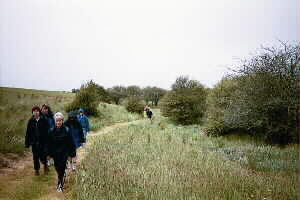
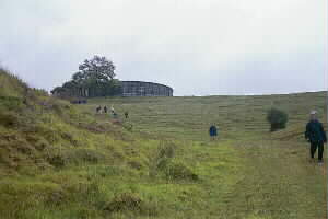
From the reservoirs we quickly dropped down and out on to Sylvia Park Rd then on to Mt Wellington
Highway, and our afternoon tea stop at Wendy’s out of the howling wind. Bert Henham Reserve was only
five minutes further on, and we crossed this reserve, walking down the grassy slope and across the sports
field - that is, everyone except Eileen, who chose to roll down the slope!
|
|
 |
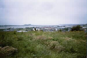
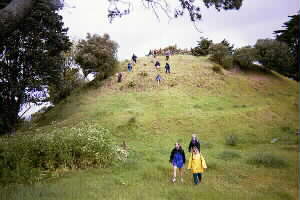
Perhaps the smallest of about six former quarries on Mt Richmond was at the south end facing Bert
Henham Reserve, and we had a look at this before climbing up the peak directly behind. This turned out
to be a small peak in area, and we dropped down and up to one of the main peaks to the north. We were
able to look down into one or two of the other old quarries as well as see one of the craters and get
views out towards Otahuhu and Otara. Then it was down and up another ridge, then down to the roadway
coming in from Great South Rd.
|
|
|
|
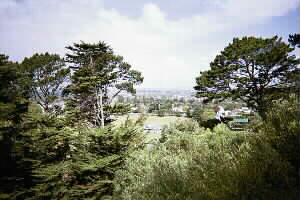
The option was given to climb back up to the more open ridge with the trig, or to follow the roadway
out. Everyone opted to go up to the trig for more views of the Penrose-Onehunga area, and see the water
reservoir - there was once a water tower as well but that had since gone - before dropping down the spur
to come out at the gate of the roadway on Great South Rd, and a 15min walk back to the Hamlins Hill car
park.
|
|
|
|
|
|