
This was a repeat of a trip the Club did in 1997 but this time we tramped the Ernies Track circuit in
a clockwise direction, with the steep part of the track as a grunt rather than a quick drop. Fourteen
people came along.
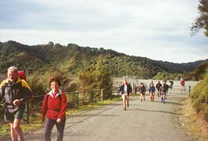
We left The Bracken about 8:30am and drove to the carpark at the foot of the
Mangatahwiri Dam in the Hunua Ranges, the start and finish of our tramp. It was about 10am when we set
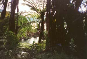
out to walk up to the dam then onto Waterline Road. This followed alongside the Mangatawhiri Reservoir,
with good views of the reservoir, and eventually began to climb gradually up into the hills at the end
of the reservoir. Ernies Track goes off to the right about halfway up this part, but somehow we missed
it and ended up having our morning tea break at the junction with the Mangatawhiri Challenge mountainbike
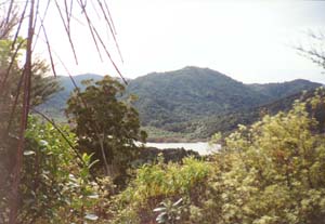
track, where there was a view of the head of the Mangatawhiri Reservoir.
|
|
 |
|
|
|
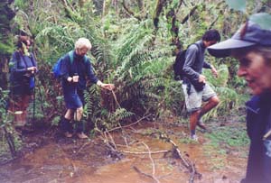
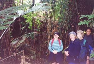
Grant, our leader, went down to try and find the start of Ernies Track, and the rest of us followed
soon afterwards. We did find it about five minutes downhill - apparently the sign had been removed, possibly
by vandals. Ernies Track began as a steady downhill through native bush to come to the flat area at the
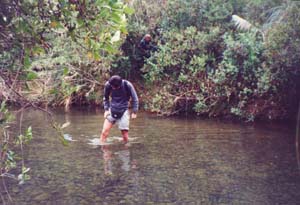
head of the reservoir, with several swampy patches. Then we had to cross the Mangatawhiri Stream, deep
enough to get the bottoms of our shorts wet.
|
|
|
|
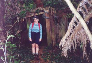
The track carried on past two well-dilapidated old buildings, apparently a farm house and a shed
going back to the days before the Auckland City Council purchased the land for water supply purposes
at the start of the 1930s. In those days a trip to Auckland was so arduous that it would be attempted
only once every few years. The house was surrounded by thick bamboo that had grown up over the years.
|
|
|
|
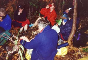
Beyond these buildings began the big grunt to the hilltops on the eastern side of Mangatawhiri valley.
It was a steady climb but with no tricky parts. About three-quarters of the way up we stopped for lunch,
about 12:30pm, on the track - we decided to stay in the bush rather than select a viewpoint because the
wind was coming up.
|
|
 |
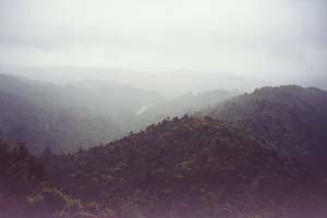
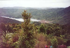
The track soon came out to an area of open grass, once farm pasture, with good views back down to
the head of Mangatawhiri Reservoir and the rest of the Mangatawhiri valley. But on the horizon we could
see rainclouds doing their business.
|
|
 |
We entered the bush again for a further grunt, then another open patch before some more level bush
travel. At times the yellow track markers were difficult to find, in fact some of them had been pulled
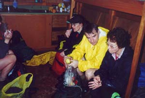
off and left on the ground. By now the rainclouds had come our way, and we were glad to come out to the
tiny four-bunk hut at the end of Lilburne Road and enjoy afternoon tea under shelter. The hut had been
occupied by a lone mountainbike tourist, who had made a mattress out of fern fronds on his bunk to put
his sleeping bag and pillow on.
|
|
|
|
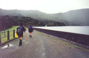
It was still raining steadily as we left the hut for the hour-long walk down Lilburne Road back to
the Mangatawhiri Dam. About halfway down the road we were able to take off our parkas and enjoy views
of the reservoir and pass a couple of large stands of pines, the result of experimantal plantings of
exotic pines in 1960 by the Auckland Regional Authority to investigate their effect on the environment.
We came out to Mangatawhiri Dam about 4pm, thence back down to our cars to complete an interesting
day’s tramping.
|
|
 |
|
|
|
|
|