|
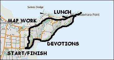
Base map: NZTopoOnline, extracted April 2003, Crown Copyright Reserved
|
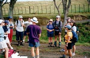
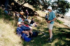
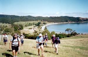
The surprise of a bright sunny calm day after four wet days brought out twelve people to explore
the orienteering opportunities of the Duder Regional Park. Our top-class map-and-compasserologists Peter
and Val Osborne were in charge, and we all came away with some excellent practice for future tramping
trips.
We left The Bracken at 8am and met up with others at the Duder carpark north of Clevedon
at 9am. Peter showed us how to set a map, that is to align a map by placing a compass on it, lining the
edge parallel with the north-south grid lines on the map, and turn it around so that north on the map
lines up with north on the compass. He then showed us how to align a map without a compass, by looking
at features shown on the map and lining it up.
|
|
|
|
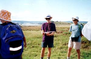
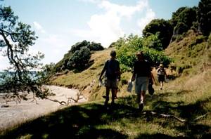
Our first exercise was to use the map to find the first checkpoint on the permanent orienteering
course set up on Duder Regional Park.
We had an elevenses stop at our second checkpoint after
repeating the exercise, then carried on to locate six more points, one being at the trig marking the
highest point on the regional park
|
|
|
|
|
 |
Out came the compasses for our next exercise. Each person (apart from four people who decided to
work as two pairs) was given a marker, being a blue bottle top with a letter marked on it. The exercise
was for the person to place the marker on the ground, take a bearing of 120°, walk 10 paces, then take
a bearing of 240° and walk 10 paces, then a bearing of 360° and go 10 paces. The person should then finish
at where the marker was placed, completing a triangle. The exercise was repeated with bearings of due
north, due east, due south and due west to complete a square.
We then applied what we had just
learned in using our compasses to find two more checkpoints, the first one on the fenceline overlooking
the sea to the north, and the second one behind a barn.
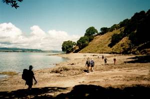
From there we used our compasses to locate
a gate, then follow a track using our maps to locate our final checkpoint, just before our lunch stop
beside a beach not far from the end of the peninsula. The tide was out, but Peter, Val and John cooled
off in the shallow water of the beach, and Stephen and Terri went for a paddle.
|
|
|
|
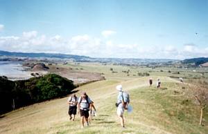
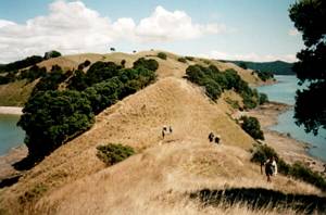
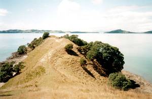
At 1:30pm we went back up on the ridge and out to the very end of the Umupuia Peninsula. It was a
glorious clear and calm day, and we could see Waiheke, Ponui and McCallums Islands, with the Coromandel
ranges behind, and the Hunua Ranges.
|
|
|
|
|
We dropped down to follow the shoreline back to the start. It was easy going all the way, with a
couple of quick group-up stops where there were shady trees. In one place we saw a heard of white geese,
and a dead penguin.
|
|
 |
We had another stop where the track from the car park finished, and Peter recalled how, on the South
Island trip, Warren Prestidge said that tramping was very much like following Christianity. Taking this
theme, Peter said that we had been learning that magnetic north was our constant direction to refer to
in map work, likewise in our lives our constant direction is Christ. When we use our maps in tramping,
we discover things, we find our way; the Bible is like our maps for our lives. John recalled a similar
devotion shared by Max Woodcock on last year’s day trip to Hakarimata, where he referred to God as our
GPS.
As we followed the vehicle track back to the car park, we passed a Manurewa Conservation
Corps gang with machetes doing clearing work on the track.
We were out by 3pm, and we icecreamicised
at Clevedon before heading home.
COST: $6
|
|
|